Accessible Trails in the Sacramento National Wildlife Refuge
by Debra L Scott

The Sacramento National Wildlife Refuge is a beautiful spot for a leisurely stroll, or a day of bird watching! A short distance off of I-5, you would expect it to be noisy and crowded. However, this peaceful 10,819 acre refuge was neither on the still Christmas day of our visit. It is about 70 miles north of Sacramento, between the towns of Willows and Orland. Dogs are permitted on a 6-foot leash.

The refuge consists of a network of paths that wind around and through the wetlands area, with ponds, waterways, islands and lagoons. A popular migratory stop off, there are literally millions of birds here in the winter. The still water creates mirror like reflections of the reeds and trees… an artist’s or photographer’s delight.  The downside? Seasonal hunting is allowed in the adjacent wetland areas, so the occasional pop of rifles disturbs the quiet, but not so much that it deters from the experience. “…the Sacramento NWR Complex helps provide habitat (resting and feeding areas) for more than 40 percent of the Pacific Flyway’s wintering waterfowl. More than three million ducks and one million geese migrate to the Sacramento Valley every fall.” (http://www.fws.gov/sacramentovalleyrefuges/)

Some recent fowl and wildlife sightings include: white-tailed kites, peregrine falcons, loggerhead shrikes, blue morph Ross Geese, the Eurasian wigeon (somewhat rare in the US) and an albino raccoon! Be aware that mountain lions have been seen in the refuge! (http://www.fws.gov/sacramentovalleyrefuges/pdf/Wildlife%20Observations/2012-13/November%202012%20Wildlife%20sightings.pdf) A colony of vultures roosted in the trees over the parking lot, eyeing visitors for possible dropped edibles.

Accessibility: National Golden Access Park passes gain free access, otherwise there is a $3 day use fee which I was told is going up to $6 in 2012.

There are choices for many types of mobility issues, including an alternate 6 mile paved track for cars to move slowly through the area. It intersects the walking trail but mostly sets off on a separate loop. Because of the height of the rushes however, walkers hardly realize they are there.

Walkers will find that the easiest track is on the north side of the entryway. Here the path is wide and flat with hard pressed dirt, circling two small lagoons. It is likely hard enough for wheelchairs and strollers and wide enough for families to enjoy walking together.

Branching off from this, to the north of the main lagoon, is a single file path through the trees which poses a few minor challenges like small but steep dips with crossings over wood bridges. The primitive bridge spans are four 6” planks set into the dip of the path lengthwise (about 24” wide) but a couple areas are only three wide (about 18”), see photos.   My legally blind partner didn’t have too much problem navigating these except on the narrow spans; one step slightly off the line nearly toppled him into the ditch. If he’d been using his cane, it might have kept him more aware of the constraints.

The treasure here is that there is a stunning view shielded by the cover of trees to a magnificent lagoon area restricted from pedestrian intrusion. Look for the half log bench along the path and peer through the trees to the north. At this spot you can enjoy just sitting, or stand on the bench for a better view.  The sound of this rich aviary display is truly magical, and worth stopping  just to listen. This northern lagoon is restricted to vehicle access only, so it is literally packed with waterfowl of all types.

The southern half of the refuge consists of a raised earth mound track through the marshes. It is wide enough for families to walk together, but the path has more of a soft feel to it. Lightweight strollers are probably fine, but wheelchairs may find it a challenge in spots.

Walk quietly through the tall rushes, enjoying the birds and wildlife close up. There are smaller side paths to wander in for the adventurous, but probably not good for unsupervised children. It would be easy to lose sight of a little person here!  It is a great place to set up tripod or easel, for close work.

The full loop is said to be 2 miles, but it felt much longer since we wound around things quite a bit exploring the crisscrossing paths. Be aware that this leg is very primitive, without available drinking water, and without tree shade. Do bring your own hydration, and of course, waste bags for dogs.

Driving directions: http://www.fws.gov/sacramentovalleyrefuges/pdf/Location%20Map/Driving%20Directions%20to%20Sacramento%20NWRC.pdf

Sacramento NWR Complex
752 County Road 99W, Willows, CA 95988 (this is NOT the address for the refuge!)
Phone: (530) 934-2801; Fax: (530) 934-7814
24-hour Information: (530) 934-7774
TTY: (530) 934-7135ImageImageImageImageImageImageImage

Wanderings of the Blind: Codfish Creek Trail, Weimar, CA.

Looking Down the Falls
From about halfway up, looking down

By Debra Louise Scott

My husband is legally blind and I have arthritis, but we love hiking so we look for things that are medium to low difficulty, and that will allow us to get back before the woods become too dark with shadows. We take our golden retriever everywhere, so the hikes need to be dog friendly as well.

On Memorial Day, we headed out for Codfish Creek Falls in the Auburn State Recreation Area of Placer County. This was a lovely little trail all in all. The directions in the guide (Best Hikes With Dogs by Thom Gabrukiewicz) mention a few things that need some clarification before talking about the hike itself.

“The trailhead is on Ponderosa Way, 6 miles south of Weimar.” Our GPS Navigator didn’tthink Weimar, California existed and put the town as Colfax. Weimar appears to consist, in fact, of one little general store.  The trailhead is not on Ponderosa Way. Ponderosa Way dead ends at the entrance to the park. The trailhead is at the end of the long access road. Both together are about 6 miles.  One person’s comment advises to park outside the entrance and walk down. That would be a very long and dangerous walk, with scant room to jump out of the way of SUV’s careening around the blind curves. Coming back would be a 1,000 foot elevation climb.

“Ponderosa Way is a rough road, made for high-clearance and four-wheeled-drive vehicles.”  Ponderosa Way itself is paved and lasts a little more than 2 miles of VERY windy road (Dramamine for everybody including the dog!) and then, at the entrance to the park it turns into a deeply rutted, very steep, narrow dirt road with continuous blind  corners for 3 miles all the way down to the water. You start at about 2000 feet of elevation and end up below 1000 feet. Regular cars can make it, although we had to take it very slow with our low clearance Prius. Pickups and SUV’s tend to take the road at inconsiderate high speeds. We met one head on coming back that barely stopped in time.  Make sure you have good traction and plenty of power to get back up the hill. I wouldn’t recommend it in wet conditions.

Once you pry your hands off the wheel at the bottom, there’s a nice beach at the trailhead, and it seems many people just stop there and hang out. There were at least fifty picnickers enjoying the warm spring day.

Although the trail is listed as easy, and in fact this is true for the most part, the trail begins with a steep scramble up an eight foot or so rise consisting mostly of crumbling shale. This was difficult for my legally blind husband, and painful for my friend with sciatica. However it’s worth the effort to get to the rest of the hike. One could conceivably go around this by walking through some low brush, but it’s debatable whether that would in fact be easier.

The trail follows the North Fork of the American River  for awhile until it gets to Codfish Creek. The guide says, “… there are plenty of side trails that lead to the water’s edge so the dogs can catch a dip and a drink.” These are about thirty to sixty feet nearly straight down and definitely not for the mobility challenged. Bring plenty of water for the dog as he won’t get a drop until you actually arrive at the falls. Nevertheless, we saw several deep pools that looked very inviting, and we thought it might be fun to make a destination of one of the easier descents in the future, providing we feel brave enough to attempt the access road again.

The trail is eroded in several places with dangerous slides where the trail has all but disappeared… our dog slipped on one and had to scramble back to the trail searching frantically for anything to get a foothold, so be careful with little ones and don’t let them run too far ahead. It looked like these areas would be little waterfalls during the rainy season so possibly impassible.

“At 1.2 miles, you’ll catch the turn for Codfish Creek and the falls.” This is a fork which isn’t marked, and which common sense would advise going to the left towards the sound of water. However, you need to defy logic and take the better traveled path to the right AWAY from the water.   I was glad I’d printed out the trail guide to take with me so I could compare the trail map! Fortunately, just as we were about to turn back in confusion, we met other hikers that confirmed we were headed to our destination.

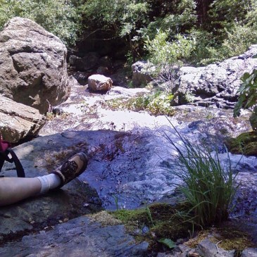
Near the end of this last half mile stretch, you finally hear the water again. In May the falls were lovely, although apparently they dry up in the summer. It’s a fairly impressive cascade with rocks on either side to scramble up if you wish. Considering this is listed in a different guide as a little known gem, I was surprised to find so many people there. There was a pretty constant trickle in and out of hikers, averaging about three groups at a time. Dogs went mostly off leash and had fun wading about together in the little pools and scrambling around on the rocks. The deepest pool was about three and half feet deep in one spot, but for the most part they were about knee deep.

Besides the falls, there are some lovely wildflowers to enjoy in the spring. Heart-Leaf Milkweed is a showy purple and white flower that looks like a bit like a lawn dart when it pops open. Tincture Plant is a bit like a white snapdragon with the blooms sitting in neat tiers around the stem. Two-Lobed Clarkia is a rare native species so keep your eye out for these scattered in the brush. It looks like a lavender pink ‘iron cross’ with each petal looking like an elongated heart. Silvery Lupine has clusters of lavender blue flowers tipped with brilliant magenta. Individual lupine blossoms are shaped like a couple of orange segments attached at one end with many of these double blooms on each stem. I saw a couple flowers that I am fairly certain were varieties of Gentian (Marsh Gentian, I think) and a couple magnificent Deer Brush bushes. (see photos).

In the middle of the falls is a healthy growth of Veined Water Lichen (Peltigera hydrothyria) which is classed as a Sensitive Plant. * In trying to identify it, I thought it was Jepsonia, but couldn’t figure out why it was growing in the middle of a waterfall. I didn’t realize that a lichen could have such a definite stalk and leaf structure.  There is also a spectacular cascade of a green lichen that I have yet to identify reminding me of an elegant ruffled satin ball gown.

If you can handle the tough drive down (allow at least half an hour just for this) and the steep initial scramble, it’s a great way to spend the day!

* “A “sensitive” plant is … one whose viability is of concern, because of low numbers, restricted range, habitat sensitivity, or some other factor.” Definition from: http://www.fs.fed.us/r5/shastatrinity/about/st-main/plants/index.shtml